Arctic Portal logo

This map shows the main Arctic Sea Routes, Sea Ice Conditions (summer and winter ice 2014/5; median line 1981-2010), Exclusive Economic Zones limits and the area covered by the IMO Code for Ships Operating in Polar Waters, known as Polar Code (IMO Delimitations).

© Arctic Portal 2006-2023
Last updated: April 2016
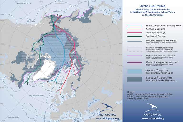
 

Arctic Portal Map - Arctic Sea Routes, Ice Conditions, EEZs, IMO Delimitations

Source

Arctic Portal, NSIDC, AMAP, Northern Sea Route Information Office, IMO

Rights

This map is free for use in presentations as long as its origin is clearly accounted for. For any commercial use of our maps, which includes but it is not limited to, selling AP maps, modify and sell AP maps, publications, reports, books, please contact info at arcticportal.org. Please note that cartographic material, as our maps, is covered under the international "Convention for the Protection of Literary and Artistic Works". The agreement covers derivative works as well.

Download map