
Mapping System and Maps
Maps
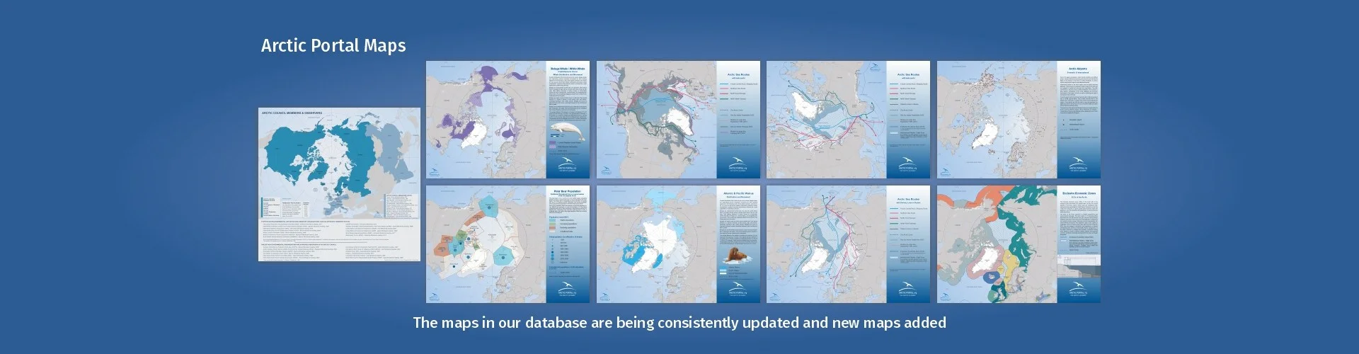
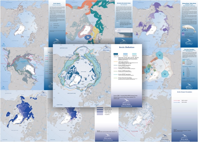
Arctic Portal specializes in creating customized graphical maps that cover a range of significant Arctic topics with global recognition. These subjects include Arctic Definition, Arctic Sea Ice, Shipping, Governance & Arctic Organizations, Arctic flora, Arctic fauna, and Infrastructure.
We consistently update and add new maps to our website, with recent additions encompassing infrastructure layouts, polar bear population distribution, various whale species distributions, walrus habitats, and Arctic shipping routes featuring projections for Northpolar-Canada and Northpolar-Russia.
All the data employed in crafting our maps are sourced either from our partners (see Arctic Portal Community) or from the most reliable and reputable databases currently available. Our commitment to transparency ensures that sources are consistently cited.
A wide selection of our maps is available for viewing, subject to our specified conditions, and can also be purchased for direct download and can then be used for open publication on the condition that the source Arctic Portal is cited.
If you are looking for a map tailored to your specific requirements, we invite you to submit a request to , detailing your preferences and needs. Our team is dedicated to assisting you in creating a map that aligns perfectly with your specifications, and we will provide cost information accordingly.
To view the available maps please click on the picture or the text - Maps Gallery.

Arctic Portal Interactive Mapping System - ADMS (Arctic Data Management System), developed by the Arctic Portal and ArcData staff, provides visual information and data on the Arctic through a state-of-the-art 3d portal.
The ADMS mapping and data management system is a Web-based GIS application implemented mainly through client-side Web programming.
All data and information layers are either connected through web-services and/or hosted on a Geo Server, owned, controlled and hosted by Arctic Portal - ArcData, shared between different instances of the system.
Discover the power of ADMS as you navigate through various layers of data, encompassing a wide range of Arctic-related information such as ice conditions, shipping routes, social data, energy resources, infrastructure, and more. The system allows you to cross-reference and visualize these datasets, enabling comprehensive analysis and insight into the Arctic's dynamics.
Furthermore, ADMS provides the option to download some of the selected datasets, empowering users to delve deeper into specific areas of interest. Unlock the full potential of ADMS and explore the Arctic like never before.
The ADMS Mapping system is used in the Arctic Council endorsed Arctic Renewable Energy Atlas project (AREA) -Visit the AREA Information System.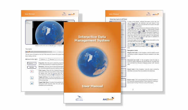
A comprehensive User Manual for the ADMS System & the AREA Information System is available by clicking on the text or the picture. Whether you are a novice or an experienced user, this tutorial will guide you through every aspect of ADMS with clear and concise instructions. Discover the full potential of ADMS and learn how to effectively manage and analyze your data.
The Arctic Portal & ArcData staff is continuously working to update the ADMS Mapping System and to create new maps for our visitors' benefit.
If you want to suggest new maps, or if you think there are any errors, please contact .