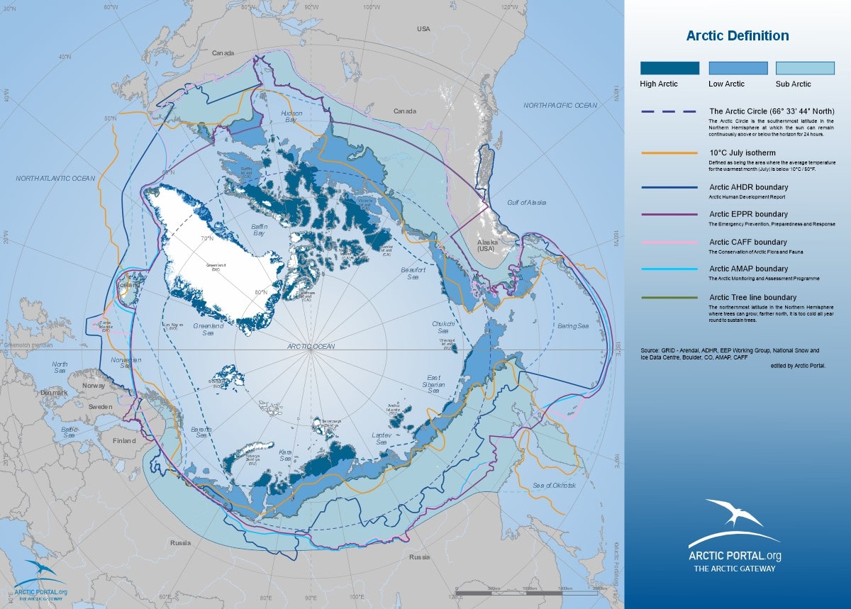
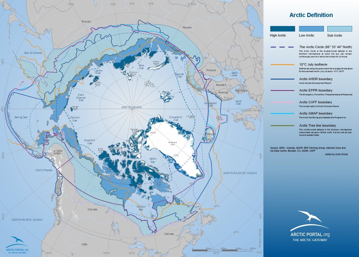
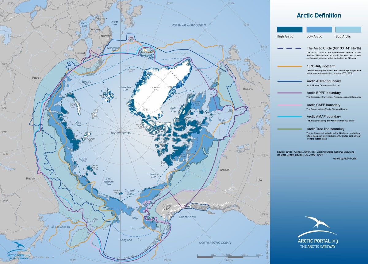
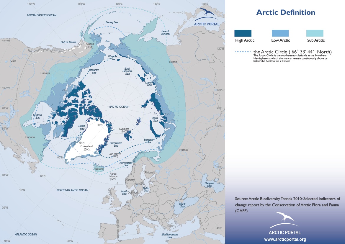
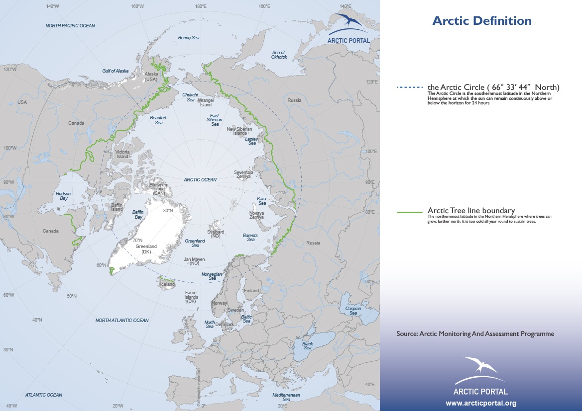
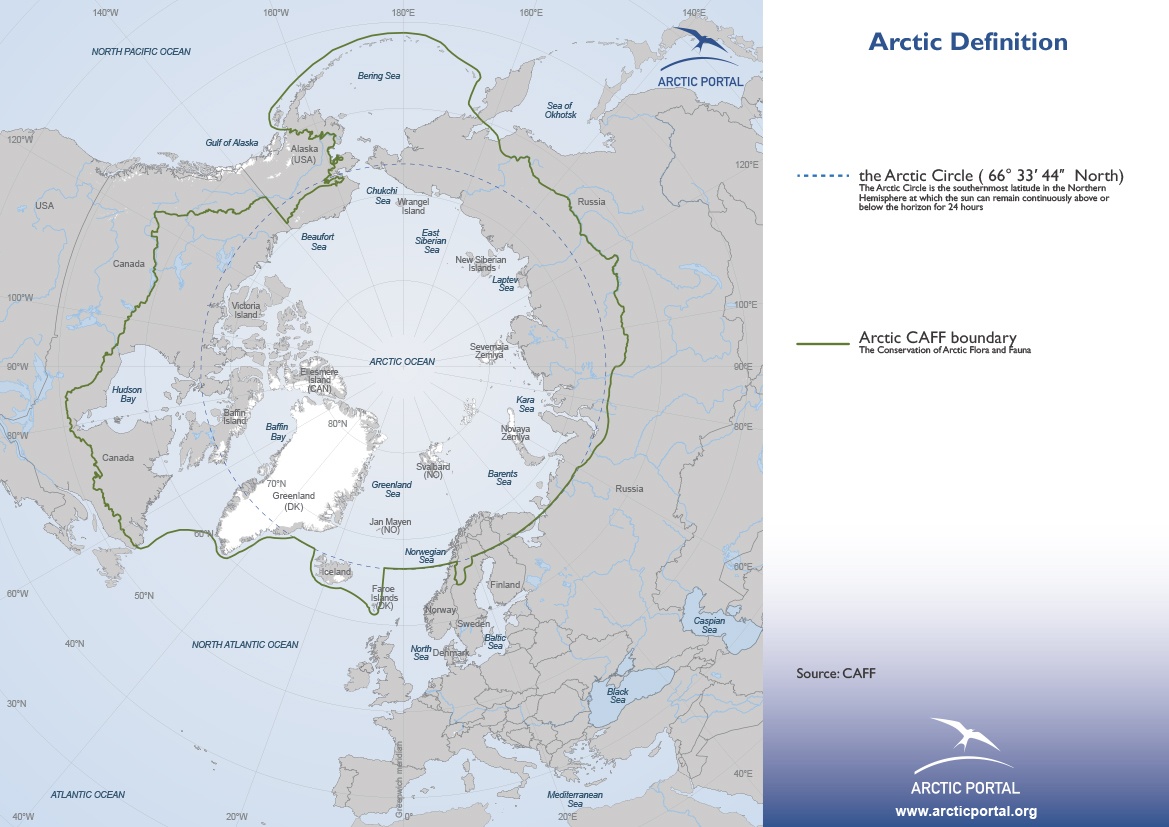
Arctic Definitions
Under this section, a selection of maps representing the main definitions of “Arctic” is presented.
Maps can be combined among them or with maps presented under other sections (as for instance Arctic Summer Sea Ice extent and “Arctic definitions”). All maps can be downloaded for free for use in presentations as long as its origin is clearly accounted for.
Maps downloadable here are optimized for the computer screen; to obtain maps for printing, please contact Arctic Portal.
For further information, such as enquiries on maps with higher resolutions or with different dataset combinations, please contact info at arcticportal.org.
This map shows the main definitions combined currently in use to describe the Arctic.
© Arctic Portal 2006-2023
Last updated: April 2016
The different sub-regions of the Arctic.
© Arctic Portal 2006-2023
Last updated: April 2016
The northernmost latitude in the Northern Hemisphere where trees can grow
© Arctic Portal 2006-2023
Last updated: April 2016
The Arctic area under the definition of the Arctic Monitoring and Assessment Program
© Arctic Portal 2006-2023
Last updated: April 2016
The Arctic area under the definition of the Conservation of Arctic Flora and Fauna working group
© Arctic Portal 2006-2023
Last updated: April 2016
The Arctic area under the Emergency, Prevention, Preparedness and Response
© Arctic Portal 2006-2023
Last updated: April 2016
The Arctic area described by the Arctic Human Development Reports(AHDR 1 and 2)
© Arctic Portal 2006-2023
Last updated: April 2016
The 10ºC Isotherm is defined as being the area where the average temperature in the warmest month (July) is below 10ºC / 50ºF.
© Arctic Portal 2006-2023
Last updated: April 2016
The Arctic Circle (66, 33, 44 North): the Arctic Circle is the Southernmost latitude in the Northern Hemisphere at which the sun can continuously remain above or below the horizon for 24 hours.
© Arctic Portal 2006-2023
Last updated: April 2016