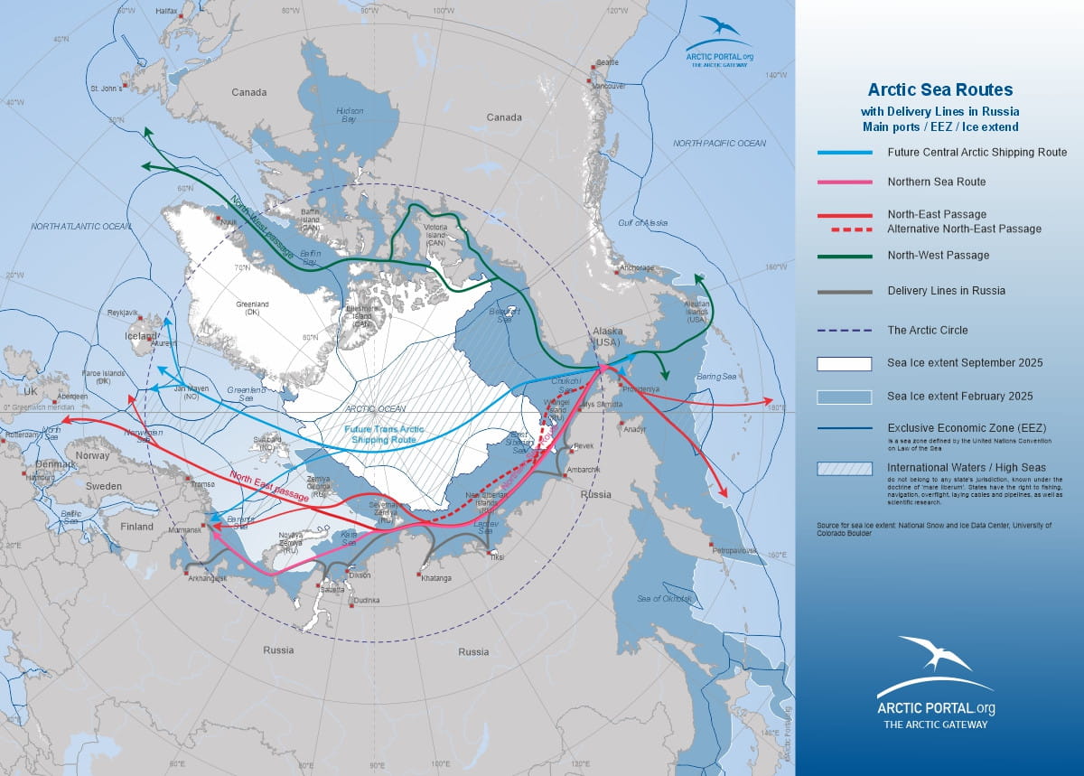
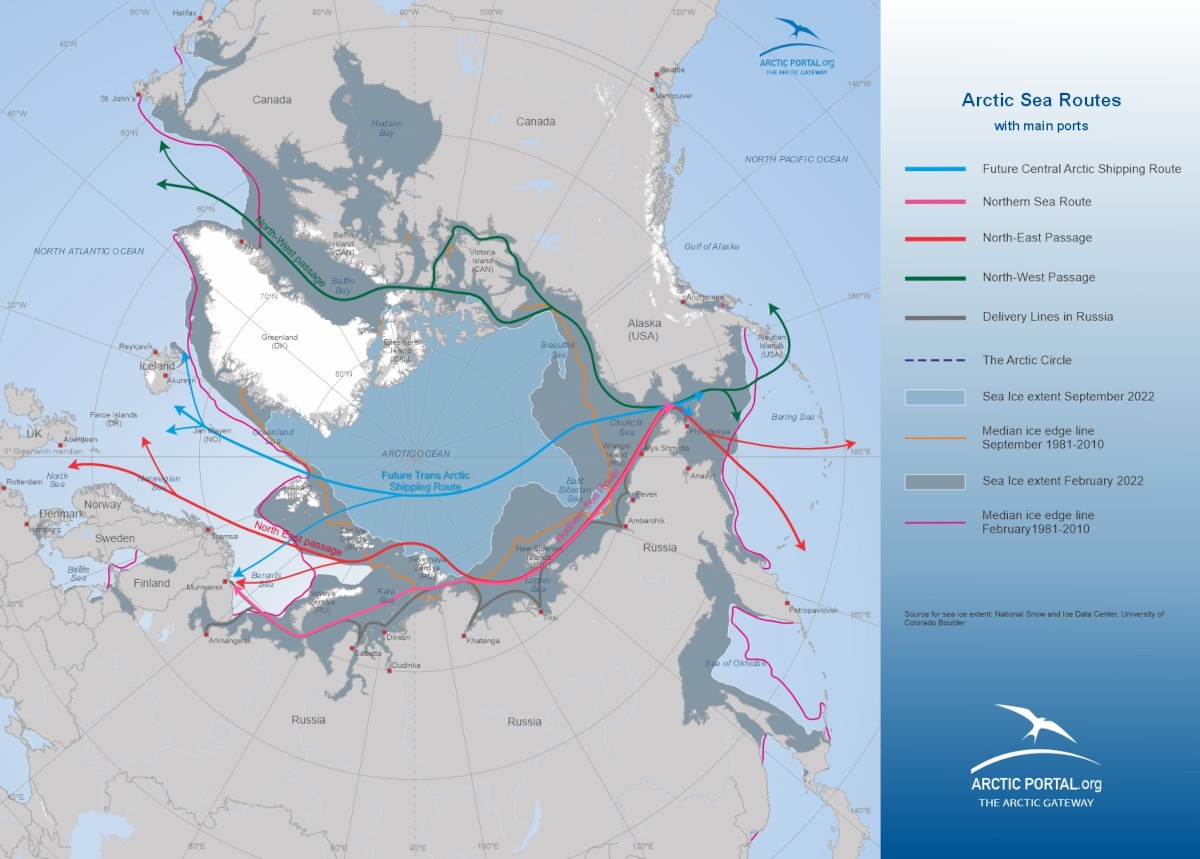
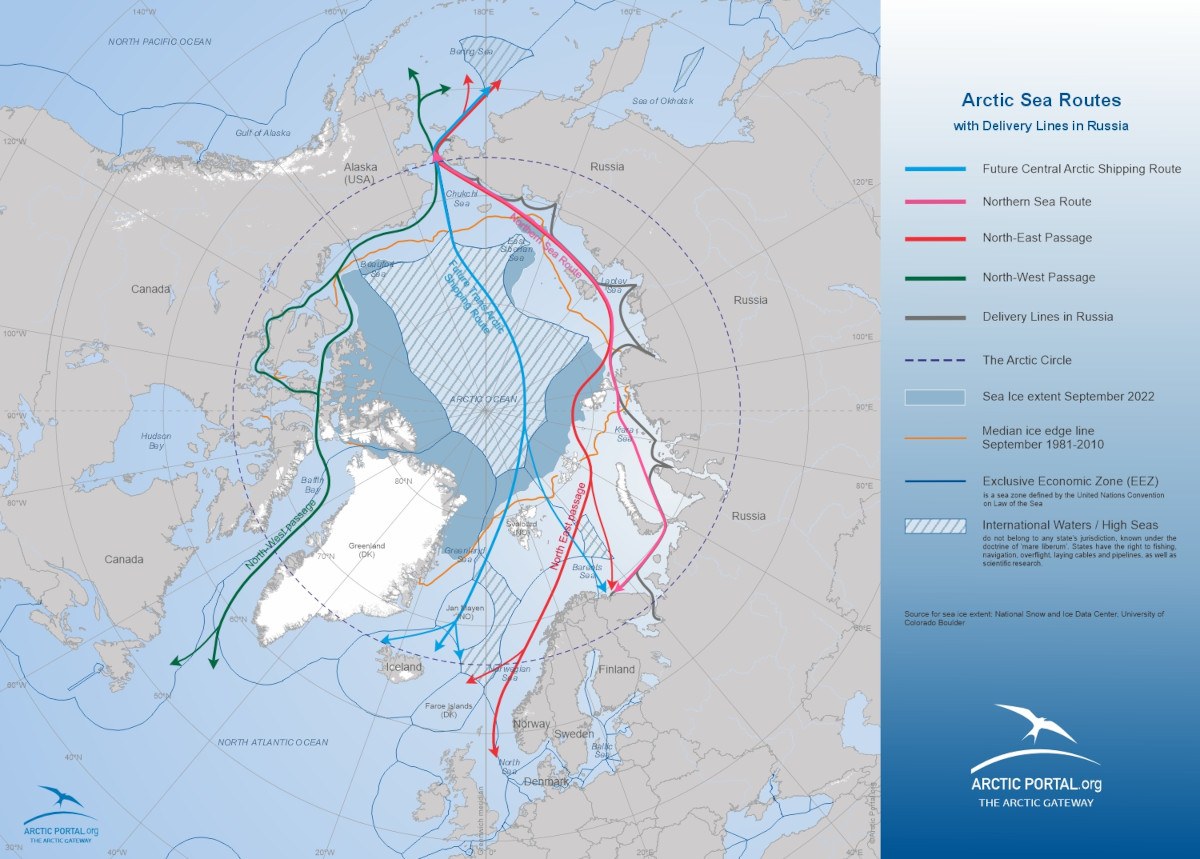
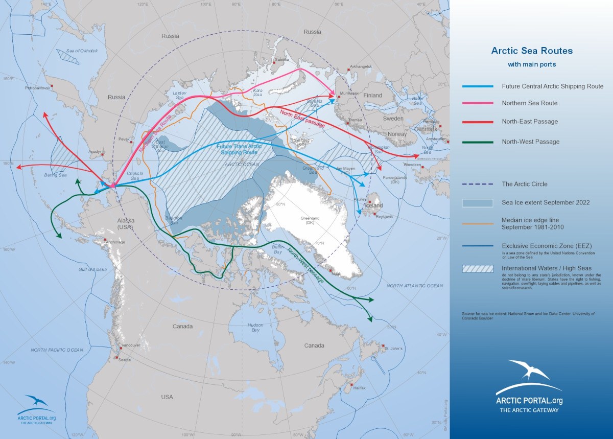
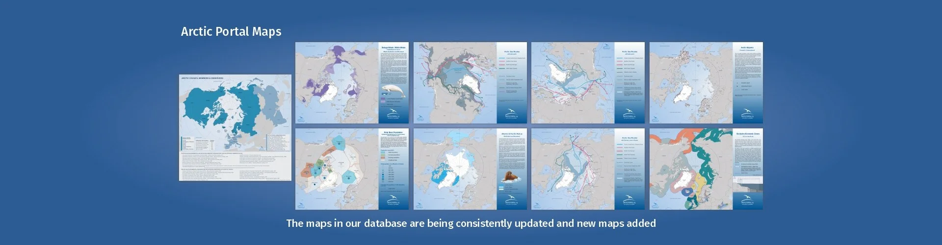
Arctic Portal logo

Shipping

Under this section, a selection of maps representing the main features of “Arctic Shipping” is presented. Maps can be combined among them or with maps presented under other sections (as for instance Arctic Summer Sea Ice extent and “Arctic Definitions”).

For any further information, or for requiring maps with different data-set combinations, please contact info at arcticportal.org.

Arctic Portal.org needs your support to continue its successful journey! - Help us make Arctic Portal.org even better!

Map: Shipping routes in a global context

This map shows Sailing Routes or Shipping in a global context. In addition it shows the Arctic Circle, Sea Ice extent from September 2022 and the Exclusive Economic Zone.

© Arctic Portal 2006-2023
Last updated: September 2023

Map: Shipping routes in a global context

This map shows Sailing Routes or Shipping in a global context. In addition it shows the Arctic Circle, Sea Ice extent from September 2022 and the Exclusive Economic Zone. Projection: North Polar-Bering

© Arctic Portal 2006-2023
Last updated: September 2023

Map: Arctic Sea Routes with main ports - Northpolar Russia projection

This map shows Arctic Sea Routes with main ports and sea ice extent September 2022. This map includes: Future Central Arctic Shipping Route, Northern Sea Route, North-East Passage, North-West Passage and Sea Ice Extent September 2022. The map is using Northpolar Russia projection.

© Arctic Portal 2006-2023
Last updated: August 2023

Map: Arctic Sea Routes with main ports - Northpolar Russia projection

This map shows Arctic Sea Routes with main ports and sea ice extent September 2022. This map includes: Future Central Arctic Shipping Route, Northern Sea Route, North-East Passage, North-West Passage, Sea Ice Extent September 2022, EEZ and International Waters. The map is using Northpolar Russia projection.

© Arctic Portal 2006-2023
Last updated: August 2023

Map: Arctic Sea Routes with main ports full information

This map shows Arctic Sea Routes with main ports and sea ice extent September 2022. This map includes: Future Central Arctic Shipping Route, Northern Sea Route, North-East Passage, North-West Passage, Sea Ice Extent September 2022, EEZ and International Waters.

© Arctic Portal 2006-2023
Last updated: August 2023

Map: Arctic Sea Routes with delivery lines in Russia - Full information

This map shows Arctic Sea Routes with delivery lines in Russia and sea ice extent September 2022. This map includes: Future Central Arctic Shipping Route, Northern Sea Route, North-East Passage, North-West Passage, Sea Ice Extent September 2022, EEZ and International Waters.

© Arctic Portal 2006-2023
Last updated: August 2023

Map: Arctic Sea Routes with main ports and sea ice extent 2022 - Northpolar Canada projection

This map shows Arctic Sea Routes with main ports and sea ice extent September 2022. The map is with Northpolar Canada projection.

© Arctic Portal 2006-2023
Last updated: August 2023

Map: Arctic Sea Routes with main ports - Northpolar Canada projection

This map shows Arctic Sea Routes with main ports. The map is with Northpolar Canada projection.

© Arctic Portal 2006-2023
Last updated: August 2023

Map: Arctic Sea Routes with main ports

This map shows Arctic Sea Routes with main ports. The map includes the Future Central Arctic Shipping Route, Northern Sea Route, North-East Passage, North-West Passage

© Arctic Portal 2006-2023
Last updated: August 2023