
News
GTN-P database has been launched
Permafrost is a direct indicator of climate change and has been identified as Essential Climate Variable (ECV) by the global observing community. The monitoring of permafrost temperatures, active-layer thicknesses and other parameters has been performed for several decades already, but it was brought together within the Global Terrestrial Network for Permafrost (GTN-P) in the 1990's only, including the development of measurement protocols to provide standardized data.
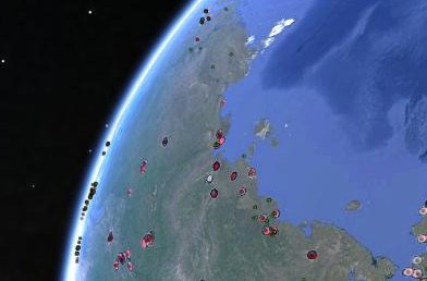
GTN-P is the primary international observing network for permafrost sponsored by the Global Climate Observing System (GCOS) and the Global Terrestrial Observing System (GTOS), and managed by the International Permafrost Association (IPA). All GTN-P data was outfitted with an "open data policy" with free data access via the World Wide Web.
The existing data, however, is far from being homogeneous: it is not yet optimized for databases, there is no framework for data reporting or archival and data documentation is incomplete. As a result, and despite the utmost relevance of permafrost in the Earth's climate system, the data has not been used by as many researchers as intended by the initiators of the programs. While the monitoring of many other ECVs has been tackled by organized international networks (e.g. FLUXNET), there is still no central database for all permafrost-related parameters.
The European Union project PAGE21 created opportunities to develop this central database for permafrost monitoring parameters of GTN-P during the duration of the project and beyond. The database aims to be the one location where the researcher can find data, metadata, and information of all relevant parameters for a specific site. Each component of the Data Management System (DMS), including parameters, data levels and metadata formats were developed in cooperation with the GTN-P and the IPA.
The general framework of the GTN-P DMS is based on an object oriented model (OOM), open for as many parameters as possible, and implemented into a spatial database. To ensure interoperability and enable potential inter-database search, field names are following international metadata standards and are based on a control vocabulary registry. Tools are developed to provide data processing, analysis capability, and quality control. Our system aims to be a reference model, improvable and reusable. It allows a maximum top-down and bottom-up data flow, giving scientists one global searchable data and metadata repository, the public a full access to scientific data, and the policy maker a powerful cartographic and statistical tool.
To engage the international community in GTN-P, it was essential to develop an online interface for data upload. Aim for this was that it is easy-to-use and allows data input with a minimum of technical and personal effort. In addition to this, large efforts will have to be produced in order to be able to query, visualize and retrieve information over many platforms and type of measurements. Ultimately, it is not the layer in itself that matter, but more the relationship that these information layers maintain with each other.
Click here to access the GTN - P Database
The tags below provide an opportunity to view previously posted related news within the selected category