
News
Arctic Portal Maps for Free Download
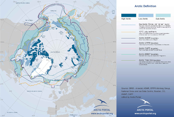
A selection of Arctic Portal maps are now available online for free download. Since 2009, Arctic Portal has been providing visual information about Arctic related information (as sea-ice conditions, shipping lines, resources, Arctic people, governance, etc..) through various databases.
The system is powered by the Inter-Map mapping system, developed by the Arctic Portal staff.
All data utilized to create our maps are provided either from our partners, either from the best reliable databases currently available (sources are always quoted clearly).
At the moment you can browse the section "Arctic Definitions", but new will come in the next few weeks.
All maps can be downloaded and used for free, behind quotation of the source (the suggested quotation is : Map provided by www.arcticportal.org) . For any commercial use of our maps, which includes but it is not limited to, selling AP maps, modify and sell AP maps, pubblication, reports, books, please contact us.
Arctic Portal.org needs your support to continue its successful journey! - Help us make Arctic Portal.org even better!
The tags below provide an opportunity to view previously posted related news within the selected category