New 3-D topographic maps of Alaska were recently released to help with better decision-making in the US Arctic state, according to The National Geospatial-Intelligence Agency website.
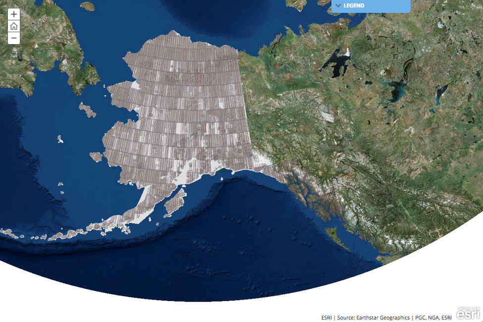
The National Geospatial-Intelligence Agency (NGA) and the US National Science Foundation (NSF), along with the University of Minnesota and other members of the academic research community, private sector and international partners, have produced the first-ever high-resolution, satellite-based elevation data map of Alaska, which is available on an open public portal, along with tools for end users.
The 3-D digital elevation models, or DEMs, are based on two-metre resolution images captured by Digital Globe commercial satellites, which orbit the poles every hour. This technology is significant in polar mapping because it allows for more thorough coverage of the Arctic than did traditional imagery collection by aircraft, which is limited given the inhospitable and remote conditions of the polar regions.
The models are the first to come from the ArcticDEM project, which was created after a January 2015 executive order calling for enhanced coordination of national efforts in the Arctic. This project has started with Alaska, but by the end of 2017 — after a supercomputer in Illinois has crunched all the satellite data — it will cover the entire Arctic above 60º north latitude in Canada, Russia, and other Arctic countries, according to the National Geographic website.
Mapping Alaska will “provide critical data and context for decisions related to climate resilience, land management, sustainable development, safe recreation and scientific research”, said Robert Cardillo, NGA director.
Scienticts and researchers are already excited about the ArcticDEM project. "It's a biologist's dream, a geologist's dream, a geographer's dream. Anybody who deals with the surface of the Earth needs these data," said Paul Morin, director of the University of Minnesota's Polar Geospatial Center, who is overseeing the production of the new maps from satellite imagery.
Not only scientists, but also villagers from Alaska can benefit from the new data, as soon as the new maps show, for example, the coastal erosion and the melting permafrost. "With villages deciding to relocate and all the upheaval that causes, these maps are not coming a minute too soon," said Mark Brzezinski, Director of the Arctic Steering Commitee at the White House.
The ArcticDEMs are the benchmark against which future landscape-level changes due to, for instance, erosion, extreme events, or climate change can be measured. Satellite imagery can be collected and DEMs produced at regular intervals—weekly, monthly, or annually—to observe and document changes as they occur, according to the White House blog.