
The melting of the Greenlandic glacier is rapid. The record of 2010 was not broken this year, yet it was over the long term average melt.
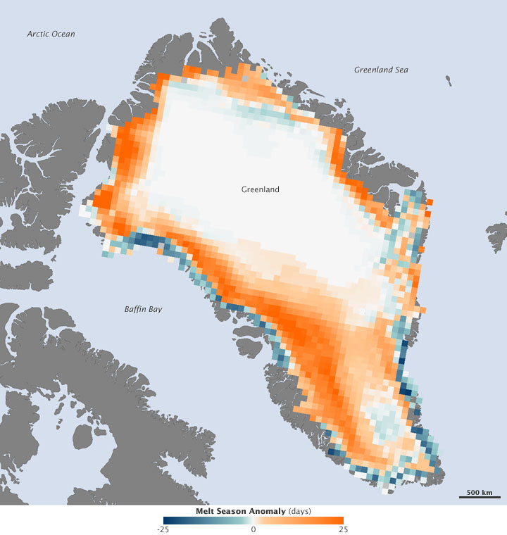
The National Oceanic and Athmospheric Administration (NOAA) has compiled the melting days in an image which shows where the melting occurs.
Melting was exceptionally high over the western mid-elevations, and the map shows the area swathed in orange.
In some places, the melt season lasted up to 30 days longer than average (the top of the scale corresponds to anomalies 25 days or more), and it affected 31 percent of the ice sheet surface, making 2011 one of just three years since 1979 where melt area exceeded 30 percent.
According to the Arctic Report Card, ice mass loss from Greenland in 2011 was about 430 gigatons, enough ice to raise global sea level by just over 1 millimeter.
Source: NOAA